


River Thames – Marsh weir reconstruction
Client: Enviroment Agency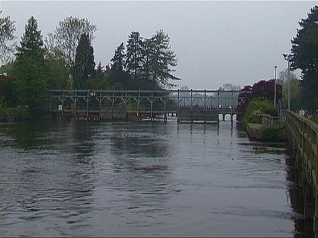
Scale: 1/40th
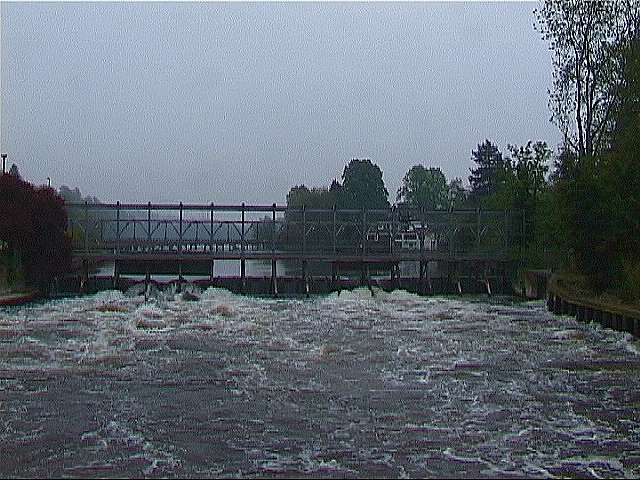
A model study was required to determine the effect of replacing the existing lifting weir with a new buck weir arrangement at Marsh Weir on the River Thames at Henley, Oxfordshire, England. Of concern was the effect of the new weir arrangement upon the bed profile and flow pattern, particularly relating to existing structures, i.e. footbridges, abutments and river banks.
The river channel in this area has been subject to historical development with the existing weir replacing a prior arrangement located a short distance upstream. A navigable lock is located to the left of the weir and a sluice to the right. Relatively recent additions to the channel have been made, including a breakwater immediately downstream of the lock exit and a fish pass to the left of the weir. The footbridges have been subject to local scour, resulting in recent placement of concrete bagworking to the timber bridge piles.
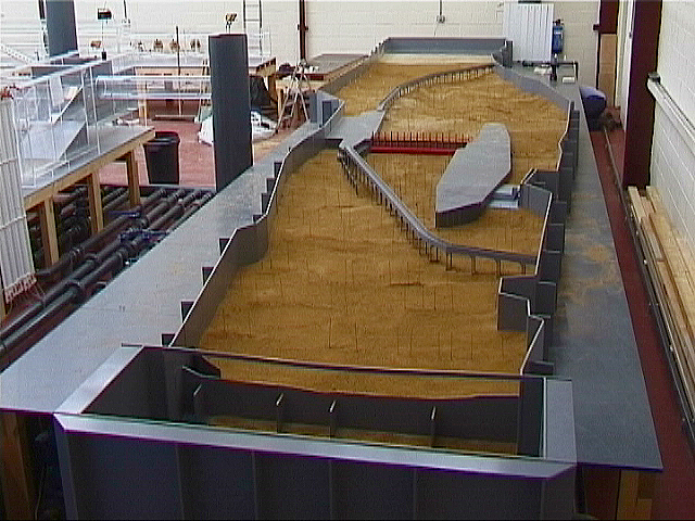
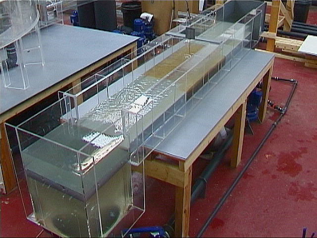
The physical model was constructed primarily in order to establish likely changes to the bed profile in the vicinity of the existing and revised weir arrangement. The model was therefore constructed from a point upstream and downstream of the weir, sufficient to minimise disruption to model flow patterns, in order to allow full scale flow conditions to be reproduced as far as practically possible. The model reach extended 300 m upstream of the weir and 200 m downstream. The river width was defined by the main river limits, which were extended vertically upwards above the predicted top water level in accordance with the Specification. This was carried out in order to contain all flows within defined boundaries for the purposes of scour assessment.
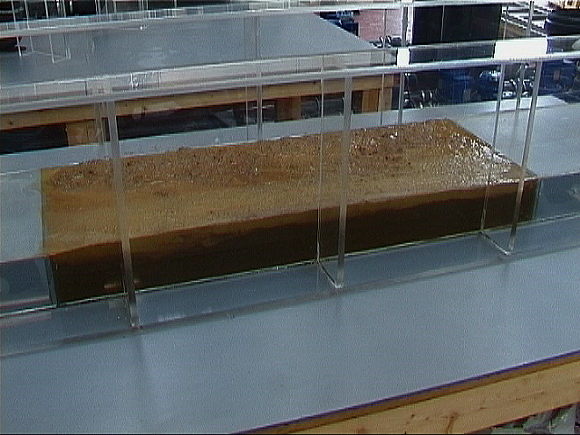
Survey information was supplemented by existing photographic records and by an inspection and photographic survey of the river carried out in June 2001. A watertight channel, which formed the outer limit of the model, was constructed from opaque plastic and the bed profile was established in accordance with level soundings records.
A comparison of bed survey data with current conditions demonstrated that little change has occurred local to the weir structure in the recent past. The bed profile, or bathymetry, was therefore set out at the surveyed sections using marker rods, which were extended above the top water level in order to allow identification of both deposition and scour. The rods were sufficiently slender to prevent any significant interference to flow patterns.
The objectives of the physical model test were defined by the Model Test Specification as follows :-
- Determine the effect of replacing the existing lifting weir with a new buck weir.
- Enable alternative gate operating scenarios to be evaluated.
- Determine an optimum weir arrangement and establish hydraulic conditions for a range of operation.
Moorfield Estate
Yeadon
Leeds LS19 7YA
e: info@hydrotecltd.co.uk
w: hydrotecltd.co.uk

